October 14, 2011

Charleston, SC cont

Each morning we leave our parking spot at the Elks Lodge and drive over the Ashley River bridge to the peninsula. That is us back behind the Live Oaks and Sweet Gum trees. No neighbors, just us.


We usually find a spot along the battery south of Broad. This elevated walk follows the shore around the east side of the peninsula.


There are always folks walking or sitting and relaxing in this park while they are guarded from the yanks! Not far from this spot is Ft. Sumter where the Civil War began.


 I don't know how they get the ivy to grow on the fronts of the steps. Every place is so beautifully manicured and gardens are just everywhere.


As we strolled up Church Street we stopped at the Huguenot Church, the last independent Huguenot church in the nation. The first church was built here in 1687 and the present Gothic Revival building was complete in 1844.


I had heard that there was a plaque with one of my grandfather's names on it and sure enough. The walls are adorned with plaques in honor of men who gave money to the church for its reconstruction after the Civil War.

The market is always an interesting place to visit. It was quite crowded but that is my idea of a real arts and crafts fair. 


 Here you will find plenty of women making the famous sweetgrass baskets that are anything but cheap.

The city hall was built in 1801 and is a most handsome building that has survived an earthquake, tornadoes, and hurricanes. It has been refurbished as has so much of Charleston.


We especially enjoyed seeing the John Trumbull 1791 painting of George Washington. At the far end of the city council meeting room full of old desks and cane chairs is the Samuel F.B. Morse painting of James Monroe.

This is supposedly the oldest house in Charleston according to the artist who has his shop there. It is three story and also had a basement as did many houses. It had been a lawyer's office for years and is now owned by a lady in Charlotte.


These cane chairs were in many of the pews in one of the old churches. Look familiar, Kay?


The Douxsaint House is one of many listed on the national register of historic properties in Charleston. This one is in a part of town called the French Quarter. It has a single front with the porch or piazza on the side of the house as is typical with many houses here. This was done possibly to pay fewer taxes due to the amount of your house on the street or to perhaps avoid the sun and have cooler breezes.


On this 3 story building you can see the crosses that are part of the bolts that run through the attics of the houses to prevent damage during an earthquake.


This is so typical of how well manicured and beautiful much of Charleston is.


Charleston began as Charles Town in 1670 on the east side of the peninsula alongside the Cooper River. Much of the town was walled off to prevent invasion by Indians and others.


The Powder Magazine is the oldest public building in Charleston. It was built in 1713 as a place to store their gunpowder supplies.


There are so many ways to see Charleston if you choose to neither drive nor walk. These folks were taking one of the easy and informative rides.


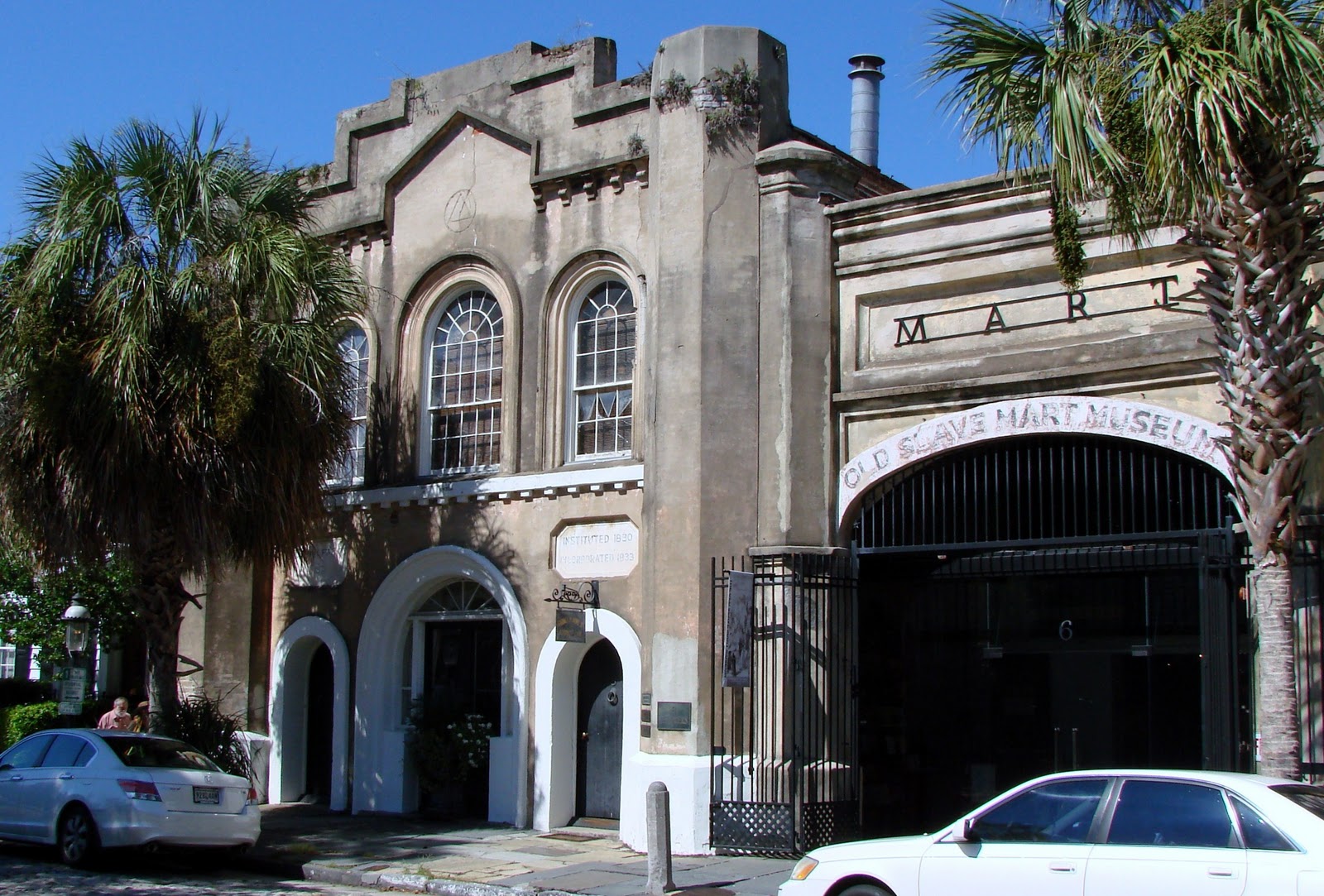
Further down Chalmers Street we came to the old fire station and the old slave mart, now a museum.  It was built in 1859 as a city ordinance in 1856 prohibited the public sale of slaves. It is now a museum.
Walking is not easy in the older parts of town. The cobblestone or brick streets and sidewalks with bricks or mostly large rock squares make it difficult. We best get out of town before we trip and break something.


Folks with nice houses often have nice cars. This is a more modern Rolls Royce than another we saw.  This is not us leaving town!

One of the last places we visited in Charleston was the park alongside the Cooper River off Concord. It was the weekend and tourists were just everywhere. 

And not far from there we found Noisy Oysters on N Market Street. I know that nobody cares what I ate for lunch but it explains why I look like I do. Oysters, fried tomatoes and grits. Why not?


And I probably have 200 more photos of Charleston. I won't bore you any longer but I learned long ago that when it comes to taking pictures that buildings are my passion.

October 13, 2011

Charleston, SC

We arrived at the Elks before the employees and waited until they opened at 4 to select our spacious home for a couple of days. After the five o'clock traffic settled we took off for South of Broad on the peninsula.
 

The Edmonston Alston House was built on the High Battery in 1825 and enhanced in 1838.It is a fine example of Charleston's commitment to elegance, style, and comfort. It is one of many we chose not to tour. We would just gawk as we walked.


The Old Exchange and Provost Dungeon was built in 1771. Here Stede Bonnet "The Gentleman Pirate" and his crew were imprisoned prior to their hanging. This is also where the British held prisoners in the cellar in 1780. Washington visited several times during his Southern tour.
A visit with this pirate was nice but we opted not to take his $8 tour of the dungeon.
We walked along Broad Street, lined with art galleries.
No matter where we went the steeple of this Episcopal Church caught my eye. It is on Church Street in an older section of town.
Rainbow Row is a popular artist subject and tourist attraction on East Bay.

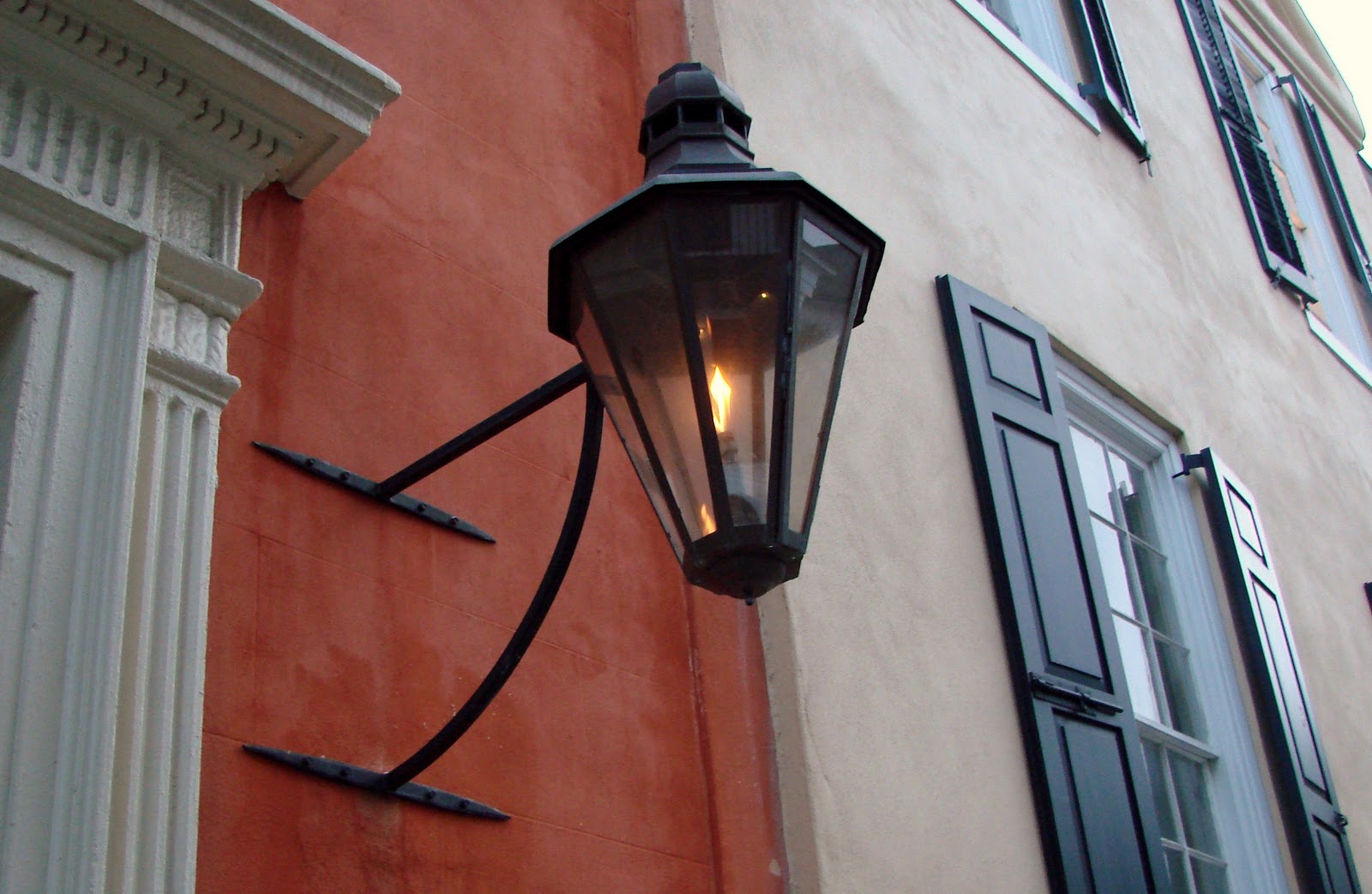
I imagine there is more iron in Charleston than anywhere. There are iron gates, dodads, light posts, hitching posts, boot scrapers, and the list goes on.


As dusk settled in someone steered us wrong on some directions as we were headed back to the truck and it almost turned into a fiasco. But we saw a beautiful moonrise over the water in Charleston Bay, many iron gates, lots of big houses, louvred and solid shutters. I am not sure south of Broad is how Leon referred to our 2.62 mile walk.

October 12, 2011

Rock Hill, SC

We got another early start as this would be our scenic drive day. I looked at the atlas and spotted a dotted road that was much further north than we had planned to go. Away we went across the foothills of the Appalachians south of Chattanooga. We arrived at 76 which turned out to be an excellent 4 lane road that runs across the top of Georgia paralleling 64 in North Carolina, one of my favorite routes. But this road is much less narrow and winding in spots. The leaves are changing and we had a magnificent drive looking at the greens, reds, oranges, yellows. We decided to stop in Clayton, Georgia at the Walmart instead of Lake Sydney Lanier further south. It turned out to be a rainy night in Georgia.


 The next morning we hopped on the interstate since it was still raining and zipped on over to Rock Hill, South Carolina to visit with Bill and Merv. There was a scenic route across northern South Carolina but we passed on that due to the rain.


We had a fantastic stay at their place. Bill gave us a tour of his rv. He is quite busy driving tour buses in his retirement. I guess he always did want to be a bus driver ever since the long trips he took on the bus to Alabama each summer. Merv stays busy selling books on Amazon. This librarian wanted no part of that.


I would rather just hop behind the wheel and take off down another dotted (scenic) back road.

October 10, 2011

Monte Sano SP, AL

We rolled from Searcy right across 64 to Memphis and then dropped down to Corinth, Mississippi where we stopped for lunch and picked up a couple of MS geocaches. The cotton was white and fluffy and appeared ready for harvest.


Our destination was Monte Sano State Park on the other side of Huntsville. We did not stop for astronaut training. I wonder what will happen with their Space Camp program!


Monte Sano, the mountain of health, rose abruptly on the outskirts of Huntsville, Alabama and what a beautiful place.

We walked the North Plateau Trail that led us to the overlook, to several geocaches, and to the Werner Von Braun Observatory. It is a shame we did not have more time on our schedule to spend here.


There I am signing the log for my first Alabama cache.


We joined Leon's cousins Nancy, Tony, and Terri, and their friends for a delicious supper and campfire. The temperatures dropped as we ascended the mountain and we would be in long pants and long sleeves for several days. Leon doesn't like the flash on my new camera!

October 09, 2011

Heading east

A fantastic first day of our holiday began with a drive into the Ozarks on a gorgeous fall-like day to meet with Leon's Ramsey cousins in Fox, a small community in northern Arkansas.


 Being in the area just makes you feel like you are on top of the world. We drove up one way and returned on roads even less traveled.


After a visit and potluck with cousins we stopped by the Little Red River at JFK Campground. Lots of people were trout fishing on this Saturday afternoon.


The winding road led us back to Searcy where we were "camping" at the Elks Lodge. Then it was off to my daughter's house to watch the Razorback game with her family. Woo Pig Sooieeeee. We beat Auburn 38-14. Kay worked on her computer during commercials and fed us some fine football fare.


 Flave was kind enough to grill all sorts of dogs..veggie, brats, etc


 Flave wandered around being his usual good looking self.


Lola made sure that Reid did not drop a crumb.


Fall is in the air so we know not how long we will be on the road.


 We sent the quads up the road and we are sure all is in good shape on the home front.


May 10, 2011

Russellville, Arkansas

Alongside the banks of the Arkansas River was once the site of the Western Cherokee Nation. The Indians settled in this valley in the late 1700s. A group of Cherokee left western North Carolina to escape the encroachment of the Europeans. Now the lock and dam facilitates traffic on the river. The only smoke signals in the area now arise from the nuclear power plant in the background.
The Corps of Engineers campground on Old Post Road suited us fine for a weekend. Just 1 1/2 hours from home and we were camping again!

We had a peaceful spot high on the banks of the Arkansas River.
The locks can be seen on the right side of the dam. This was also the area of a bustling riverport town, Norristown, an early settlement along the old post road. The mail crossed the river here by ferry until the late 1800s when the longest pontoon bridge to cross moving water was built. It did wash out four times in it's 30 years of service.

Our reason to be here was the Russellville geocaching event being held at the day use portion of the park. Here we all looked for a cache on the bleachers at the ball field.
Sometimes it takes a taller person to help retrieve a cache.

After a morning of caching we enjoyed a fine potluck with hot dogs and hamburgers.

A little geocaching around Russellville on Sunday morning led us to this "London calling" cache. I thought if anyone was watching (a muggle) that I would make them think I was just making a phone call.
On the way home we made the steep winding ascent up Mt. Nebo.
What a view from every side. This is the Arkansas River and Lake Dardanelle below.

The 375 Step cache led us down this path. We did not count the steps. It took all the energy just to get up them! There are several interesting hiking trails on Mt. Nebo.
And we thought the road from Hot Springs to Russellville had some serious curves.
They were really releasing some water from Lake Nimrod, further south towards Hot Springs, where we stopped to see all the water flowing down the Fourche La Fave River.