October 01, 2006

Ca to Ar on I 40


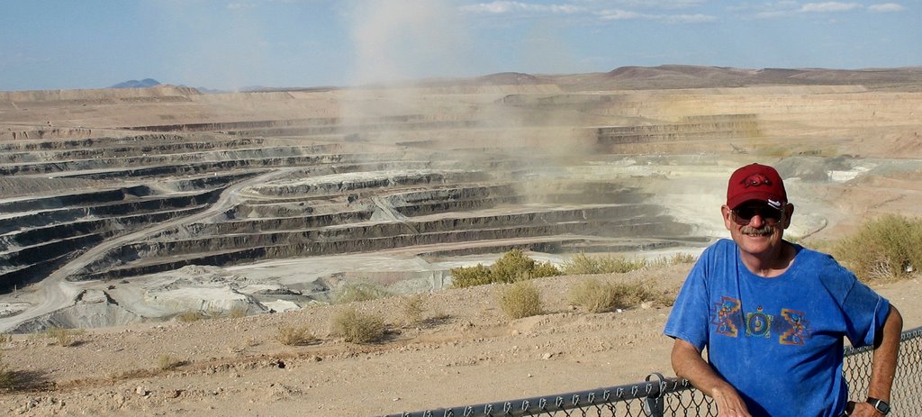
We left Tehachapi on October 1 with the toy hauler loaded and headed for Hot Springs. Leon drove the toy hauler and I drove Hernando. We managed to arrive in Kingman, Az in time for an early supper at El Palacio, a favorite Mexican restaurant. We walked along Route 66 for a few minutes before heading east again.

The plan was to stop for the night at a roadside park at dark only to find it closed. We found a spot in Ash Fork, Az in an empty lot next to the Rancho Cafe and went in for a coke and bowl of ice cream. It was like we had walked on stage in a tv sitcom: a guy wearing a pistol and holster, 3 sheriffs, some perhaps truck drivers, and some of the locals. Leon thought it was quite noisy in the night with trains passing constantly – I heard nothing.


At 7 am we were on the road again and finally got to New Mexico where gas was $2.39 a gallon and that is a good thing! We planned to stop at a rest stop before Tucumcari at dark only to find it closed also. We drove on to Tucumcari and were delighted to find a Kmart full of RVers. We enjoyed driving around town looking at the old Route 66 stops with their neon lights still glowing.
We ate breakfast at Denny’s and waited for the sun to come up to leave. We weren't in a rush as we wouldn't make it to Hot Springs in one day, but we did!

September 20, 2006

Boron, Ca

We took a day excursion out to Boron, about 40 miles east of Tehachapi to visit the Borax Museum. We first stopped by the Saxon Aerospace Museum which is small but has some very nice displays. Then we stopped in town at another small museum, the Twenty Mule Team Museum, which was most informative. Here we learned that the movie Erin Brockovich starring Julia Roberts had been filmed here. Also the tv show Death Valley Days starring Ronald Reagan had made many people aware of this area.

From there we went to the Boron plant which has a museum also. We were quite surprised in a video they showed that so many products are made from borax. This is quite a major production in this small desert town.


It is hard to believe that a wagon such as this would make a 165 trek from the desert at Death Valley to take borax to the railroad junction located in Mojave. This took place from 1883 - 1886 and was a 20 days round trip. The mules were extremely well trained which was required to navigate through the mountains. The bells on the lead mules would signal ahead around curves to let oncomers know they were there.


We were visiting near the end of their workday and while we were looking over the mines they had set off a blast to evidentally prepare for the next workday.


From the top of the hill at Boron we could look across the highway at Rocket Mountain. This is a part of Edwards Air Force Base that has played quite a role in the history of the space explorations.


We then drove back across the Mojave desert, past the Joshua trees, past the wind turbines, and through the mountains to Stallion Springs Drive.

September 05, 2006

Sequoia National Park, Ca


After Labor Day and the beginning of school we decided it was the perfect time to visit Sequoia National Park. We got setup alongside the creek in Lodgepole Campground and one of our first ventures was to climb to the top of Moro Rock. It was still a little hazy as it was early in the day.


What a climb and what a view!

Then we were off to find Tharp's Log. This is a "summer home" built in a fallen Sequoia log where a rancher lived in the summers from 1861-1890 when Sequoia was developed.

Tharp would bring his cattle from Three Rivers to the mountains to graze in the meadows at the higher elevation.


After passing Tharp's Log we came to Crescent Meadow. When John Muir visited Tharp he proclaimed this meadow as the "Gem of the Sierras."

We then drove the crooked road thru the Giant Forest and on to the Grant Grove Area which took about an hour. We located a nice campsite in Azalea Campground, which was a little more spacious camping due to the lack of crowds in this area . Then we took a winding and most scenic road down the mountain to Hume Lake, a beautiful little lake surrounded by a Christian Campground. The lake had been built to send logs down the river as they cut the giant sequoias in the area. We got some propane and returned to the campground where we enjoyed grilling burgers on the logs procured from vacated campsites while watching the squirrels attack our food. The next morning all the chipmunks were busy knocking pine cones out of the trees and then running downhill with pinecones three times their size to bury them beside a fallen log. We went down to the Grant Cove area, which is located in Kings Canyon National Park, and hiked to Grant's Tree, the 3rd largest Sequoia.

We then returned to the Lodgepole Campground stopping at the many vistas and taking small hikes along the way.
One special hike was to the Panoramic Point overlook. A narrow winding 2 mile road led us up the hill. Thank goodness we were traveling small. The view of Hume Lake below with the mountains beyond was breathtaking (or was it the hike?).


We also stopped to take a look at the General Sherman tree. It is the largest living thing in the world by volume. Other trees may be taller or wider but none contains the mass of this giant.

We then took the 1 1/2 mile Big Trees Trail that circles Round Meadow. Many cabins had been built in this area and the last one was removed in 1999. Optimum conditions exist around this meadow for the giant Sequoias to thrive and thrive they do. We then scurried back to the campground for hot dogs and potatoes cooked over the open fire with s'mores for desert.


On Friday we vacated our campsite and set out on the 3 1/2 mile hike to see Tokopah Falls and hopefully a bear. We heard the bear in the woods but never saw one but we did make it to the falls. It was our favorite hike as it was more of a natural setting and not so crowded as the other small hikes. The trail followed along the Marble Fork of the Kaweah River at a 500 foot elevation gain until it ended at the giant granite cliffs and the waterfall of Tokopah Canyon. The hike back to the truck was downhill and most pleasant. We saw many signs of bear feeding on logs in the area. I am not sure if I was glad or disappointed to not see a bear.

It was a pleasant 2 hour drive back to Tehachapi after a great 4 days of hiking, sightseeing and camping.

August 29, 2006

Tehachapi, Ca


After the trip to Solvang Leon had his hernia surgery and most of August was spent in Tehachapi taking life easy. Gary and Betty drove up from Bakersfield and spent a couple of days with us. Betty, Leon and Gary are at the overlook to watch the sun set over the San Joaquin Valley and Bakersfield, Ca.

August 03, 2006

Solvang, Ca


On August 3 we visited the quaint tourist town of Solvang, a Danish community founded early in the 20th century. Many buildings were built in the half timbered style but with stucco timbers. We ate a Danish lunch and toured the town. Then we stopped for dessert - a Danish and coffee.


The storks on rooftops are a symbol from Denmark that brings good luck. Many of the buildings were adorned with storks. I couldn't resist wandering around town looking for them.


From Solvang we headed south to take the long and scenic route. We stopped at Carpenteria State Beach. After wading in the chilly water we continued south and decided to cross the mountains instead of going through the Ventura traffic at 5 pm. It was a wise choice as the drive was quite scenic as it took us through the small town of Ojai. Then we were going north again on "the grapevine," a section of interstate named for a small community nearby but I would have thought it was named for the way it twisted like a grapevine. Another fine day ended back in Tehachapi.

July 29, 2006

Paso Robles, Ca

We left the Carmel area on July 29 and headed south. But it won't be the last visit to the area. What a holiday!

We stopped at a winery in Paso Robles. There were nice picnic tables under the vine-covered arbors so why not a picnic on the grounds. Then it was on to Tehachapi and Leon's hernia surgery. He was quite a trooper since we had planned this vacation before the surgery. And a great time it was!

July 28, 2006

Big Sur, Ca


We took a daytrip along the coast of California on highway 1 beginning at Carmel and going south. There was little traffic early due to a light fog and the trip was most rewarding. We stopped at Napenthe for a dining experience while overlooking the Pacific.


Around every curve was another awesome view. The coastline has few inhabitants. It is quite a drop down to the water's edge.


Be sure to see more of our Big Sur photos.

After passing through Lucia we turned east and went across the mountains. What a climb on a wide one lane road with plenty of hairpin curves in the Los Padres National Forest. We drove through Camp Hunter Liggett and stopped at the San Antonio Mission.


I am always amazed at how much history is preserved in these old missions. This mission was founded in 1771 by Father Junipero Serra.
There were interesting displays inside and you could imagine people working these areas, such as this candle making corner, several hundred years ago.


I thought if I saw one mission that would be enough but such was not the case. I found that each one was very different from the last.

There are more photos of the mission.


After leaving the mission we went looking for the Pinnacle Mountain National Monument. There are two sides to the monument but you can not cross in the middle. It was a nice drive along winding backroads.


From the Pinnacles we drove across the "Salad Bowl of America," the area around Salinas, California, where so much of the food consumed in the United States is grown. We passed by row after row of newly planted trees and broccoli plants that looked like dwarf trees. We took the Carmel Valley Road back to Robert and Rose's and passed wild turkey, deer, and coyotes along the way. I was really surprised to see trees with Spanish moss in California. It was another long and rewarding day!

July 27, 2006

San Juan Bautista, Ca


After leaving San Francisco we stopped by the San Juan Bautista Mission in the town of the same name. It was not a planned daytrip so we arrived after it had closed. But we were still enthralled by this little old historic town. The Plaza Hotel is located across the street from the mission. The area was settled in 1834.


There was a portion of the original El Camino Real aka the King's Highway which connected the 21 California missions behind the mission. This was the 15th of the 21 missions. It was founded in 1797.


The house or casa of Juan de Anza was built in 1799 and is several blocks from the mission. The mission had been built to colonize the San Francisco Bay Area after Juan Bautista de Anza had led and expedition for Spain in 1775/1776.


There are more photos at Flickr

Sausalito, Ca

Before leaving the San Francisco Bay area we drove over to a quaint little town on the opposite side of the Golden Gate Bridge, Sausalito. Although the fog had moved into San Francisco we were in bright sunshine. We strolled along the bay looking across at the city we had enjoyed and stopped for our final bowl of clam chowder in a bread bowl.


We drove by the Golden Gate Park but decided to leave it for our next trip. We will cross this bridge again!


I never thought of this as a camouflage jacket or thought I would find a tree to blend in with. The entire trip I marveled at how large the flowers and shrubs and how brilliant the flowers in central California.

July 25, 2006

San Francisco, Ca


San Francisco has been on my list of places to visit for a very long time. In July we spent 4 wonderful days there, staying at the Cathedral Hill Hotel on Van Ness. Each morning started with breakfast at Mel's Diner across the street. We enjoyed the trolleys, cable cars, buses, and even the BART for our mode of transportation around town. We rode the Bay Area Rapid Transit under the bay to Oakland just for the experience.


We traveled over most of the town visiting many of the quaint neighborhoods that included Chinatown, Fisherman's wharf, North Beach, Nob Hill and Japan Center. At Coit Tower we had a wonderful view from atop the hill before descending for an Italian dinner.


On the final day in town we chose the truck for our mode of transportation, which probably would have saved a lot of time had we used it earlier. But we would have missed the experience of standing on a chilly street corner at night wondering when the next bus might come. Leon finally got to drive down the curviest street in America, Lombard Street. Tourists gather at the bottom just to watch the happening.


The street cars took us to the outskirts of the down town area. We even got to watch two women have a fight on one ride. This one we caught down by Fisherman's Wharf and actually took the wrong one, which created a sightseeing trip.


I had no idea of the economic importance of this town for the west coast and its tremendous past history until I visited. I always marveled at the exteme differences between the old and new. Leon had spent months working in the bay area so this was not so new and exciting for him. But he was an excellent tour guide.


This was one of our many visits to Fisherman's Wharf. I was drawn to the area like a magnet. Visit Flickr for more of our San Francisco photos and the communities we visited while there.

July 23, 2006

Santa Cruz, Ca

We left the trailer in the corral at Robert's and headed north along the beach. We stopped in Santa Cruz and after touring the visitor friendly downtown section we headed to the beach. We couldn't resist riding the tram and spending time at the Boardwalk.

All along the beach are rides and visitor attractions in this amusement park built in 1904.


We stopped at several other spots along the beach, one being the Pigeon Point lighthouse. After a Hawaiian lunch in Half Moon Bay we had to leave our drive along the beach due to construction and cross the mountains to continue to San Francisco.


More photos of Santa Cruz

July 21, 2006

Laguna Seca Raceway, Carmel, Ca


The big bike races, aka the Red Bull U.S. Grand Prix motorcycle races, are held each summer in Carmel, California. We chose a shade tree at the top of the hill near what is called the corkscrew. The cycles come across the top of the hill about 200 mph and then slow into a curve and go downhill through the corkscrew towards the bottom of the track. We saw several near mishaps. The one in front turned out to be the winner with his teammate behind him.


From the other side of the hill crowds overlook most of the track. We were there in the middle of a heat wave and everyone seemed miserable at times in the middle of the day. One day we spent in the vendor section of the track gathering freebies. Another was spent in the paddock section.

We had paddock passes which allow you to mingle with the riders and their teams. This is where they work on the cycles. The team members have autograph sessions and plenty of freebies and posters are nearby. I am visiting with the Kawasaki team.

Leon did not need a Red Bull energy drink. Just the excitement of being there made him think he had wings.

Behind him is the corkscrew which was in our viewing area. It turned out to be a great experience and we had a wonderful visit with his friends: Bud, Robert, and Rose.


For more photos visit Flickr

July 19, 2006

Carmel & Pebble Beach, Ca


Carmel lives up to its reputation in my opinion. We walked among the shops, drank morning coffee on the beach, visited the nearby mission, and stopped at Clint Eastwood's Hogsbreath Saloon. For more Carmel photos visit this link.


We especially enjoyed the nearby 17 mile drive at Pebble Beach. Pebble Beach is filled with high dollar homes and golf courses but the designated route leads you past wildlife, oceanside, and tourists. We watched golfers while eating lunch at Poppy Hills Golf Course after wading in the ocean.


On one portion of the drive there is an abundance of Monterey Cypress, windswept by time and the ocean breezes, with cottages nestled underneath.

All along 17 mile drive there were places to stop whether for a walk, to watch some golfers, to enjoy the view of or wade in the ocean, or to perhaps watch a seal climb up on a rock among hundreds of birds. We watched the sea lions manipulate their way to the beach for some sunning and an afternoon nap. It just seemed to be that time of day. More photos